ALT-Pilot: Autonomous navigation with Language augmented Topometric maps
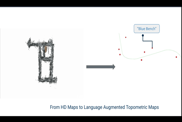
Language Augmented Topometric Maps
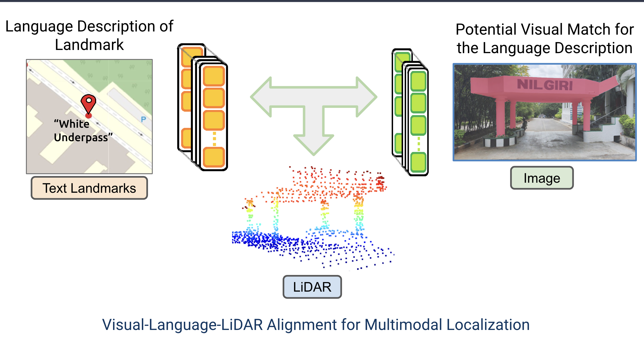
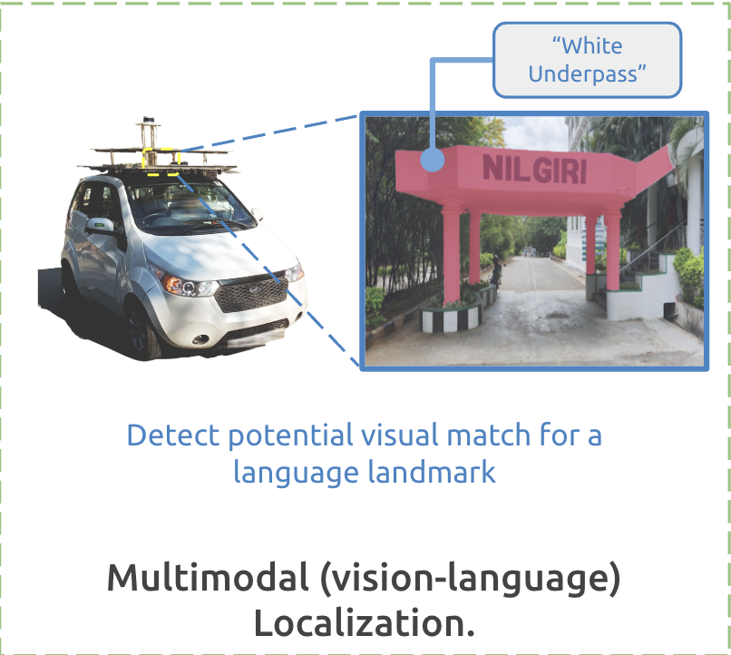
Multimodal Localization
Abstract
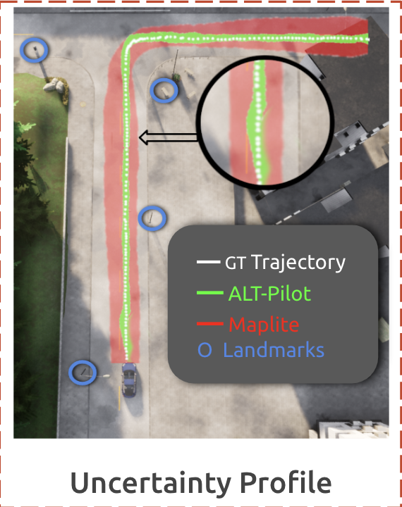
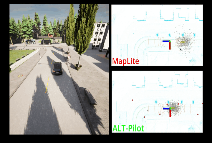
We present an autonomous navigation system that operates without assuming HD LiDAR maps of the environment. Our system, ALT-Pilot, relies only on publicly available road network information and a sparse (and noisy) set of crowdsourced language landmarks. With the help of onboard sensors and a language-augmented topometric map, ALT-Pilot autonomously pilots the vehicle to any destination on the road network. We achieve this by leveraging vision- language models pre-trained on web-scale data to identify potential landmarks in a scene, incorporating vision-language features into the recursive Bayesian state estimation stack to generate global (route) plans, and a reactive trajectory planner and controller operating in the vehicle frame. We implement and evaluate ALT-Pilot in simulation and on a real, full-scale autonomous vehicle and report improvements over state-of- the-art topometric navigation systems by a factor of 3× on localization accuracy and 5× on goal reachability.
ALT-Pilot: Pipeline
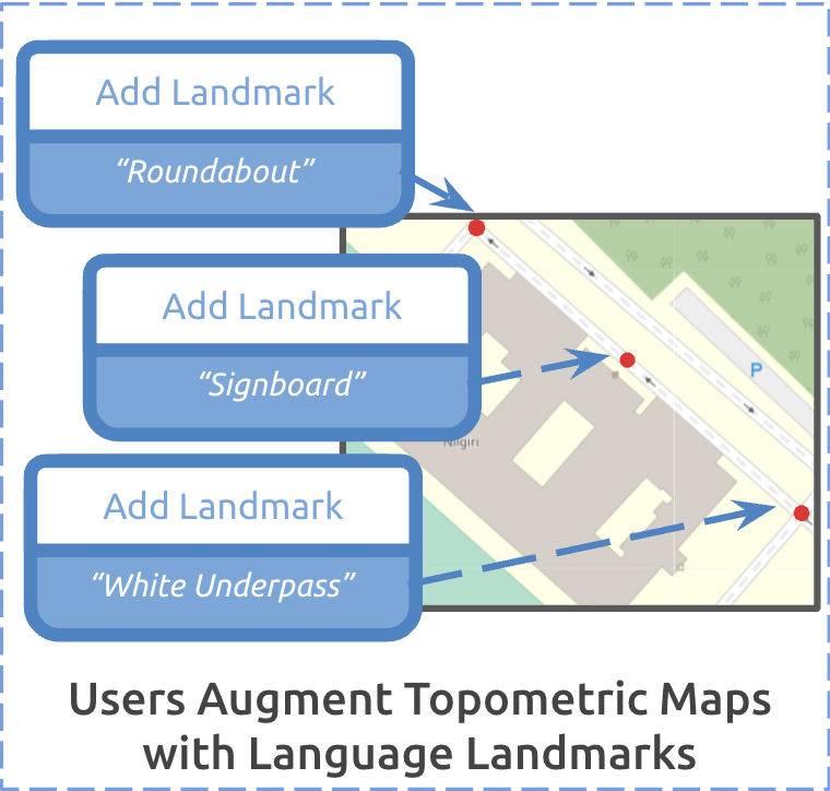
Language Augmented Topometric Maps
ALT-Pilot: Localizatioin
ALT-Pilot: Global Localization

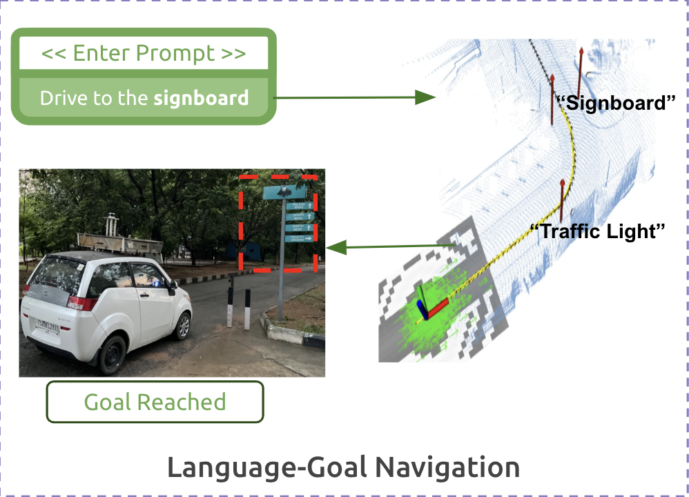
Language Guided Navigation